Posts

A Deeper Look: Wheeler County

Image
  Painted hills, Wheeler County, OR The wilderness and the wasteland shall be glad for them, And the desert shall rejoice and blossom as the rose ; Isaiah 35:1 Wheeler has the distinction of being the least populated county in the state. We’ve written about the fascinating geography and outdoor activities here. In most of the United States, the median age is 38.2, which points to the fact that Americans are living longer. In the 70’s the median age was less than 30. In Wheeler County, however, the median age is 56.9 with 34% of the residents over the age of 65. There is a real shortage of young people or young families with children. Meaning? It does not bode well for the economic future of the county, or the succession of the farms and ranches that make up a large part of the economic base. Young people grow up and leave for more populated areas with a wider variety of jobs. Wheeler County, Oregon The county was named for Henry H. Wheeler, a pioneer who was born in Pennsylvan...

A Deeper Look: Jefferson County

Image
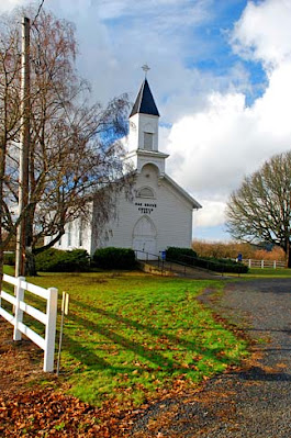
Church on Warm Springs Reservation Those who go out weeping, carry seed to sow, will return with songs of joy, carrying sheaves with them . Psalm 126:6 NIV In my own subjective and personal division of Oregon into regions, I placed Jefferson, Wheeler, Deschutes, and Crook Counties in the Central Region of Oregon. There is some debate on what area constitutes Central Oregon, but most agree Jefferson, Deschutes and Crook make up the core. Some add neighboring counties as well, as I have with Wheeler. This is high, dry, pine tree country, a semi-arid area sitting in the rain shadow of the Cascade Mountains to the west; the smaller Ochoco Mountains bounding it on the east. Central Oregon has become a tourist destination for those wanting to camp, ride horseback, rockhound or just fish, hike, and picnic.  Lumber and ranching are other major economic sources. Central Oregon Region Peter Skene Ogden, of the Hudson’s Bay Company, is credited with being the first European to lead a grou...

A Deeper Look: Polk County

Image
Polk County, Oregon Then will the lame leap like a deer, and the mute tongue shout for joy. Water will gush forth in the wilderness and streams in the desert. Isaiah 35:6 When we wrote about Polk County in an earlier post, we mentioned The Confederated Tribes of the Grand Ronde, the reservation with headquarters in Polk County, and lands mainly in Yamhill. The tribe has been expanding their lands whenever possible. The Willamette Falls site has been an important location to the various tribes of the Pacific Northwest, and in 2019 the Grand Ronde tribes purchased the 23 acres where the former Blue Heron paper mill operated, on the edge of the Willamette Falls. Work continues for that site. The original reservation of over 60,000 acres was established in 1858. In the 1950’s the federal government terminated many tribes and reservations, under the misguided belief that the Native Americans would benefit by assimilation into American culture. However, that was not the case, and this...

A Deeper Look: Morrow County

Image
But when he saw the multitudes, he was moved with compassion on them, because they fainted, and were scattered abroad, as sheep having no shepherd. Matthew 9:36 Morrow county was created in 1885, from a portion of Umatilla County to the east. It was named after Jackson L. Morrow, an early resident and state representative who advocated for the county’s formation. Hepner is the county seat, established in 1873 when Henry Hepner and Jackson L. Morrow opened the first mercantile store in the area.   Morrow County, Oregon On June 14, 1903 – a Sunday evening - Hepner experienced one of the most devastating natural disasters in Oregon history. Willow Creek, a peaceful little stream said to be about ankle deep in June, runs through the town. As many of the 1500 residents were getting ready for the evening church services, a thunderstorm began. At 5:16 a flash of lightening stopped the town clock while a mile south a sudden cloudburst released a wall of water and sent it hurling down t...

A Deeper Look: Gilliam County

Image
  Lonerock church, Gilliam County [Note: We are recycling an earlier post on Gilliam County, with some minor additions.] The pastures are clothed with flocks; the valleys also are covered with grain; they shout for joy, they also sing . Psalm 65:13 If we are traveling east along I-84 from Sherman County, the next in line, and very similar, is Gilliam County. Like Sherman County, Gilliam was home to the Tenino people who were removed to the Warm Springs Reservation around 1859.   And also like Sherman, it is bordered by rivers: the John Day to the west and the Columbia along the north. It lies at the heart of the Columbia River Plateau wheat-growing area and is known for its production of wheat, barley, and cattle. Gilliam County was created in 1885 and named after Cornelius Gilliam who commander of the military forces in the Cayuse War that took place after the Whitman Massacre. Arlington was originally the county seat but it was later moved 38 miles south to Condon. A...

A Deeper Look: Sherman County

Image
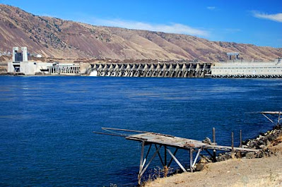
John Day Dam, Sherman county. Fishing platform For since the creation of the world God’s invisible qualities—his eternal power and divine  nature—have been clearly seen, being understood from what has been made, so that people are without excuse. Romans 1:20 On our trip to Hermiston last week we drove through Wasco County, then Sherman , which was once part of Wasco. When Wasco was formed in 1854 it was the largest county ever formed in the United States and stretched from the Washington border to the California border, and from the Cascade to the Rocky Mountains. 17 Oregon counties were later created from it, including Sherman in 1889. Moro is the county seat. In the 1880’s there was a “reverse migration” of settlers who arrived in the Willamette Valley only to find the best land already taken. They moved east and began farming and ranching on the dry eastern side of the Cascades. Some immigrants just stopped there and didn’t go on to the western side of the mountains. Enough...

A Deeper Look: Wasco County

Image
  Wasco County, The Dalles I will magnify Myself, sanctify Myself, and make Myself known in the sight of many nations; and they will know that I am the Lord. Ezekial 38:23 As it happens, I drove through Wasco County this weekend, along I-84. The trip took me to all the counties we have designated the Columbia River Region, the strip along the top of the state bordered by the Columbia River (Hood River, Wasco, Sherman, Gilliam, Morrow). It was wet. Rain is good, and these counties need the rain, but it also can make driving I-84 a challenge. We made it, though – Portland to Hermiston (Umatilla County). As we drive this region, we move through the Cascades and the forests and waterfalls of the Columbia River Gorge to the dry high desert of Eastern Oregon. The landscape changes from lush green mountains to rocky cliffs, to rolling hills dotted with windmills, and flat sagebrush-covered plateaus. The county seat of Wasco County is The Dalles. We wrote about this area earlier here...